
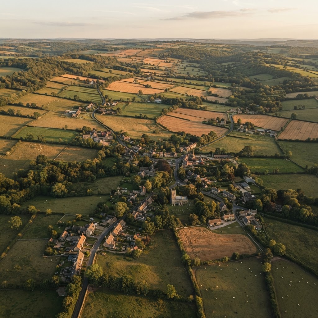
UK land intelligence · 265+ mapped layers
Explore UK Property, Planning & Environmental Data Layers
Search a public-data layer, read a practical guide, then open it on the interactive Maplify map. Sources include public authorities and community-maintained datasets; check each guide for its coverage and limitations.
Searches the layer descriptions and all 52 dedicated guides.
Plan your site research
Data layer guides
Understand what a layer displays, what it means and where its evidence needs checking before a planning or property decision.
Green Belt
Check whether land is in the Green Belt by postcode or address. View official boundaries, planning context and site constraints across England on Maplify.
View guide Planning & landPlanning Designations
Check Green Belt, Article 4 Directions, allocations and other planning designations affecting a UK site in one map on Maplify.
View guide Planning & landProperty Boundary
Check property and Land Registry boundary context for England and Wales, including title-map searches and surrounding planning constraints on Maplify.
View guide Planning & landAgricultural Land Classification
Check Agricultural Land Classification grades for a site, including Best and Most Versatile land, and understand planning implications on Maplify.
View guide Planning & landBrownfield Land
Search brownfield land registers and identify previously developed sites with planning, ownership and environmental context on Maplify.
View guide Planning & landHousing Allocations
View housing and employment allocations from adopted planning documents and assess development context for UK land and property on Maplify.
View guide Planning & landHS2 Safeguarded Land
Check whether a site is affected by HS2 safeguarded land and understand the planning implications alongside other constraints on Maplify.
View guide HeritageConservation Area
Check whether a property or site is inside a conservation area, review the mapped boundary and understand heritage planning implications on Maplify.
View guide HeritageTPO
Check Tree Preservation Orders by postcode or address, review mapped protected-tree constraints and verify local authority details with Maplify.
View guide HeritageListed Buildings
Check Grade I, Grade II* and Grade II listed buildings near a property or site and understand heritage consent implications on Maplify.
View guide HeritageScheduled Monuments
Check Scheduled Monuments and nationally important archaeological sites near land or property and understand consent implications on Maplify.
View guide HeritageHeritage Constraints
Check listed buildings, conservation areas, scheduled monuments and other heritage constraints affecting a UK site on Maplify.
View guide HeritageRegistered Parks & Gardens
Check registered historic parks and gardens around a site and understand heritage setting and planning implications on Maplify.
View guide HeritageWorld Heritage Sites
Check UNESCO World Heritage Sites and buffer zones around a UK property or development site and understand heritage planning implications on Maplify.
View guide Environment & ground riskSSSI
Check SSSI boundaries and Impact Risk Zones around a property or development site using Natural England environmental data on Maplify.
View guide Environment & ground riskEnvironmental Designations
Check SSSI, SAC, SPA, Ramsar, ancient woodland and other environmental designations affecting a UK property or development site on Maplify.
View guide Environment & ground riskAONB
Check whether land falls within an Area of Outstanding Natural Beauty or National Landscape and review planning implications on Maplify.
View guide Environment & ground riskNational Parks
Check National Park boundaries and the planning authority affecting a site, with wider environmental and development constraints on Maplify.
View guide Environment & ground riskNature Reserves
Check National and Local Nature Reserve boundaries around a property or development site and review related environmental constraints on Maplify.
View guide Environment & ground riskSAC, SPA & Ramsar
Check Special Areas of Conservation, Special Protection Areas and Ramsar sites around land or property and review environmental constraints on Maplify.
View guide Environment & ground riskAncient Woodland
Check Natural England ancient woodland boundaries and nearby habitat constraints for a site before buying, planning or developing with Maplify.
View guide Environment & ground riskNitrate Vulnerable Zones
Check whether farmland is in a Nitrate Vulnerable Zone and review NVZ planning and agricultural restrictions alongside site constraints on Maplify.
View guide Environment & ground riskSource Protection Zone
Check Environment Agency groundwater Source Protection Zones SPZ 1, 2 and 3 for a site and understand development implications on Maplify.
View guide Environment & ground riskContaminated Land
Screen a site for contaminated-land indicators, historic landfill and related ground-risk context before buying or developing with Maplify.
View guide Environment & ground riskCoal Mining Risk
Check Coal Authority mining risk, development high-risk areas and mine-entry context for a property or development site on Maplify.
View guide Environment & ground riskRadon Risk
Check mapped radon potential and Building Regulations protection requirements for a UK property or development site on Maplify.
View guide Environment & ground riskGeology
View British Geological Survey bedrock and superficial geology for any UK site and combine it with planning and environmental constraints on Maplify.
View guide Environment & ground riskGround Risk
Screen a UK site for geology and ground-risk factors including radon, coal mining, shrink-swell clay and landslide susceptibility on Maplify.
View guide Environment & ground riskAir Quality
Check Air Quality Management Areas and mapped NO2, PM2.5 and PM10 context for a UK site, with planning and property constraints on Maplify.
View guide Environment & ground riskNoise
Check strategic road and rail noise mapping and Noise Important Areas around a UK property or development site on Maplify.
View guide Transport, water & utilitiesTransport Infrastructure
Check railways, roads, HS2 safeguarding, cycle routes, EV charging and other transport infrastructure around a UK site on Maplify.
View guide Transport, water & utilitiesPublic Footpath
Check public footpaths, bridleways, byways and access land around a property or development site before buying, planning or developing with Maplify.
View guide Transport, water & utilitiesRivers & Lakes
View rivers, lakes, watercourses and water-quality context around a UK property or development site with wider constraints on Maplify.
View guide Transport, water & utilitiesLive River Levels
View recent Environment Agency river-level readings across England and combine live water context with flood and planning constraints on Maplify.
View guide Transport, water & utilitiesMarine & Coastal
Explore marine plan areas, offshore wind, shipping, subsea cables and coastal designations alongside land and planning data on Maplify.
View guide Transport, water & utilitiesWater Utilities
Explore water-company areas, treatment works, storm overflows and monitoring sites around a UK site alongside wider land intelligence on Maplify.
View guide Transport, water & utilitiesWater Company Areas
View water and sewerage company operational boundaries around any UK property or development site alongside utility and planning data on Maplify.
View guide Transport, water & utilitiesSewage Treatment Works
Check sewage, wastewater and drinking-water treatment works near a UK property or development site and assess amenity context on Maplify.
View guide Transport, water & utilitiesStorm Overflows
View storm overflow and Combined Sewer Overflow locations around a UK site and combine them with water, flood and planning data on Maplify.
View guide Transport, water & utilitiesWater Quality Monitoring
View Environment Agency water-quality monitoring sites around land or property and combine water evidence with environmental constraints on Maplify.
View guide Transport, water & utilitiesBroadband & Mobile Coverage
Check gigabit and superfast broadband availability plus 4G and 5G mobile coverage around a UK property or development site on Maplify.
View guide Local services & amenitiesCommercial & Retail
Explore supermarkets, fuel, banking, restaurants and retail around any UK site, alongside planning, property and transport intelligence on Maplify.
View guide Local services & amenitiesPublic Services
Explore schools, healthcare, emergency services, libraries and other public amenities around a UK property or development site on Maplify.
View guide Local services & amenitiesSchools
View primary and secondary schools around any UK property or development site and combine education access with wider location intelligence on Maplify.
View guide Local services & amenitiesHealthcare Facilities
View hospitals, GP surgeries, pharmacies and dentists near any UK site and combine healthcare access with wider site intelligence on Maplify.
View guide Local services & amenitiesEmergency Services
View police and fire station locations around any UK site and combine local-service checks with planning and property intelligence on Maplify.
View guide Local services & amenitiesCommunity Amenities
View libraries, post offices and recycling facilities around a UK site and combine amenity checks with wider land intelligence on Maplify.
View guide Local services & amenitiesSupermarkets
View supermarket and grocery-store locations around any UK property or development site and combine them with wider amenity data on Maplify.
View guide Local services & amenitiesPetrol Stations
View petrol and fuel station locations around any UK property or development site and combine them with transport and amenity data on Maplify.
View guide Local services & amenitiesBanks & ATMs
View bank branches and ATM locations around any UK site and combine local amenity checks with property, planning and transport data on Maplify.
View guide Local services & amenitiesFood & Drink
Explore restaurants, cafes, pubs and bars around any UK location and combine amenity research with wider site intelligence on Maplify.
View guide Local services & amenitiesCrime
Explore recent street-level Police.uk crime records around a property or location and combine local-area checks with site intelligence on Maplify.
View guideOpen directly in Maplify
All interactive map overlays
Every map-layer card opens a relevant guide or launches the selected overlay in the map viewer.
Property & Boundaries
5 layersProperty Boundaries (National Coverage)
HM Land Registry's own national parcel boundary map - covers the whole of England & Wales, but shown as an image only (not clickable) since HMLR's public service doesn't allow extracting real boundary data. Use alongside 'Land Registry Polygons' for areas with no clickable coverage.
Explore on mapLocal Authority Boundaries
UK Local Authority District boundaries (ONS May 2024)
Read layer guideBuilding Polygons
Building footprint polygons sourced from OpenStreetMap (a true OS Open Map Local layer requires an OS Data Hub API key, which is not yet configured)
Read layer guideBuilding Heights
LIDAR-derived building heights data
Read layer guideEPC Ratings (Domestic)
Energy Performance Certificate ratings aggregated by area
Explore on mapFlood Risk
21 layersFlood Zone 2
Land with 0.1-1% annual probability of river flooding
Read layer guideFlood Zone 3
Land with 1% or greater annual probability of river flooding
Read layer guideRivers & Sea - High (1 in 30 year)
High probability flood extent from rivers and sea - 3.3% annual chance
Read layer guideRivers & Sea - Medium (1 in 100 year)
Medium probability flood extent - 1% annual chance
Read layer guideRivers & Sea - Low (1 in 1000 year)
Low probability flood extent - 0.1% annual chance
Read layer guideSurface Water - High (1 in 30 year)
High probability pluvial flood risk - 3.3% annual chance
Read layer guideSurface Water - Medium (1 in 100 year)
Medium probability surface water flooding - 1% annual chance
Read layer guideSurface Water - Low (1 in 1000 year)
Low probability surface water flooding - 0.1% annual chance
Read layer guideFlood Defense Structures
Main river flood defense assets including walls, embankments and structures
Read layer guideAreas Benefiting from Defenses
Land areas that benefit from flood defense infrastructure
Read layer guideFlood Alert Areas
Areas where flood alerts may be issued
Read layer guideFlood Warning Areas
Areas where flood warnings may be issued
Read layer guideSurface Water Flood Risk
Risk of flooding from surface water (pluvial flooding)
Read layer guideReservoir Flood Maps
Maximum flood extent if reservoirs were to fail
Read layer guideMain Rivers
Environment Agency designated main rivers
Read layer guideBathing Water Quality
Designated bathing waters and quality classifications
Read layer guideFlood Storage Areas
Areas designated for flood water storage
Read layer guideHistoric Flood Map
Areas that have flooded in the past from rivers or sea
Read layer guideWater Framework Directive Bodies
Rivers, lakes and coastal waters under WFD monitoring
Read layer guideShellfish Waters
Designated shellfish water protected areas
Read layer guideFlood Risk Zones (Planning Data)
Flood risk zone boundaries from Planning Data Gov UK
Read layer guidePlanning Designations
28 layersGreen Belt
Protected green belt land with strict planning restrictions
Read layer guideAgricultural Land Class
Provisional Agricultural Land Classification (ALC) grades
Read layer guideALC Post-1988 Surveys
Detailed post-1988 Agricultural Land Classification surveys
Read layer guideLess Favoured Areas
Agricultural less favoured areas designation
Read layer guideBrownfield Land Register
Sites identified for potential housing development on previously developed land
Read layer guideArticle 4 Directions
Areas where permitted development rights have been removed
Read layer guideLocal Plans
Local authority planning policy documents
Read layer guideNeighbourhood Plans
Adopted neighbourhood development plans
Read layer guideHousing Allocations
Sites allocated for housing development
Read layer guideEmployment Site Allocations
Sites allocated for employment/commercial use
Read layer guideAssets of Community Value
Buildings/land nominated as important to community wellbeing
Explore on mapCentral Activities Zone
Central London area with specific planning policies
Explore on mapInfrastructure Projects (NSIP)
Nationally Significant Infrastructure Projects
Explore on mapDesign Code Areas
Areas with adopted design codes
Explore on mapPermitted Development Rights
Areas with specific permitted development rights
Explore on mapPrior Approval Areas
Areas requiring prior approval for certain developments
Explore on mapDevelopment Corporations
Urban Development Corporation areas
Explore on mapOpportunity Areas
Strategic development opportunity areas
Explore on mapStrategic Industrial Land
Protected strategic industrial locations
Explore on mapMetropolitan Open Land
London's equivalent to green belt land
Read layer guideGreen Belt Inset Areas
Towns and villages excluded from green belt
Read layer guideGypsy & Traveller Sites
Designated gypsy and traveller sites
Explore on mapSafeguarded Wharves
Wharves protected for cargo handling use
Explore on mapProtected Views & Vistas
Strategic views protected from development (London)
Explore on mapLocal Plan Boundaries
Boundaries of local authority local plans
Read layer guideMinerals Safeguarding Areas
Areas safeguarded from development that would sterilise mineral resources
Explore on mapWaste Safeguarding Areas
Land safeguarded for existing and future waste management sites
Explore on mapEnterprise Zones & Freeports
Designated areas with simplified planning and tax incentives
Explore on mapHeritage & Conservation
15 layersConservation Areas
Areas of special architectural or historic interest
Read layer guideListed Buildings
Buildings of special architectural or historic interest
Read layer guideScheduled Monuments
Nationally important archaeological sites protected by law
Read layer guideRegistered Parks & Gardens
Historic designed landscapes on the Register of Parks and Gardens
Read layer guideRegistered Battlefields
Historic battlefields on the Register of Historic Battlefields
Read layer guideWorld Heritage Sites
UNESCO World Heritage Sites in England
Read layer guideProtected Wreck Sites
Designated protected wreck sites
Read layer guideHeritage at Risk
Listed buildings and sites at risk of decay
Read layer guideListed Building Outlines
Building footprints of listed buildings
Read layer guideWorld Heritage Buffer Zones
Buffer zones around UNESCO World Heritage Sites
Read layer guideLocally Listed Buildings
Buildings of local architectural or historic interest
Read layer guideArchaeological Priority Areas
Areas of high archaeological potential requiring assessment
Read layer guideConservation Areas (Planning Data)
Local authority conservation area boundaries from Planning Data
Read layer guideBuilding Preservation Notices
Buildings under temporary protection while listing is considered
Read layer guideCertificates of Immunity
Buildings with certificates protecting them from listing for 5 years
Read layer guideEnvironmental
49 layersSSSI
Sites of Special Scientific Interest - protected nature areas
Read layer guideAONB
Areas of Outstanding Natural Beauty
Read layer guideNational Parks
Protected national park land
Read layer guideAncient Woodland
Woodland that has existed since 1600 or before
Read layer guideRamsar Wetlands
Internationally important wetland sites
Read layer guideSAC
Special Areas of Conservation - EU Habitats Directive sites
Read layer guideSPA
Special Protection Areas - wild bird protection sites
Read layer guideLocal Nature Reserves
Locally designated nature conservation areas
Read layer guideNational Nature Reserves
National nature reserves - premier wildlife sites
Read layer guideHeritage Coasts
Coastlines of scenic and environmental value
Read layer guidePriority Habitats
Habitats of principal importance for conservation of biodiversity
Read layer guideNational Forest Inventory
Woodland areas from National Forest Inventory
Explore on mapAncient Woodland (MAGIC)
Ancient woodland inventory from Natural England
Read layer guideLong Established Woodland
Woodland present since at least 1893
Read layer guideHabitat Networks
Strategic habitat network areas in England
Explore on mapPriority Habitats (MAGIC)
UK BAP priority habitats inventory
Read layer guideLiving England Habitat Map
Satellite-derived broad habitat classification
Explore on mapPeaty Soils
Peaty soils locations in England
Explore on mapCountryside Stewardship
Active countryside stewardship scheme agreements
Explore on mapEnvironmental Stewardship
Environmental stewardship scheme agreements
Explore on mapCS Scheme Options
Countryside stewardship management options
Explore on mapSSSI (MAGIC)
Sites of Special Scientific Interest from Natural England
Read layer guideSSSI Units
Individual SSSI management units with condition
Read layer guideSSSI Impact Risk Zones
Impact risk zones around SSSIs
Read layer guideSAC (MAGIC)
Special Areas of Conservation
Read layer guideSPA (MAGIC)
Special Protection Areas for birds
Read layer guideRamsar Sites (MAGIC)
Internationally important wetlands
Read layer guideNNR (MAGIC)
National Nature Reserves
Read layer guideLNR (MAGIC)
Local Nature Reserves
Read layer guideMarine Conservation Zones
Protected marine areas
Explore on mapWildlife Corridors
Strategic wildlife movement corridors
Explore on mapGreen Infrastructure Network
Strategic green infrastructure network
Explore on mapSpecial Landscape Areas
Locally designated landscape protection areas
Explore on mapLocal Wildlife Sites
Non-statutory local wildlife site designations
Explore on mapTree Canopy Cover
Satellite-derived tree canopy coverage
Explore on mapAONB (MAGIC)
Areas of Outstanding Natural Beauty
Read layer guideNational Parks (MAGIC)
National Park boundaries
Read layer guideHeritage Coast (MAGIC)
Scenic and environmentally valuable coastlines
Explore on mapNational Character Areas
Landscape character assessment areas
Explore on mapLocal Nature Recovery Areas
Local Nature Recovery Strategy areas
Explore on mapBNG Sites
Registered biodiversity net gain sites
Explore on mapCoastal & Floodplain Grazing
Coastal and floodplain grazing marsh priority habitat
Explore on mapMarine Conservation Zones
Protected marine areas for conservation
Read layer guideNational Character Areas
Landscape character assessment areas
Explore on mapSSSI Impact Risk Zones
Impact risk zones around Sites of Special Scientific Interest
Read layer guideTree Preservation Zones
Areas covered by Tree Preservation Orders (TPOs)
Read layer guideNature Improvement Areas
Areas designated for landscape-scale nature conservation
Explore on mapBiodiversity Opportunity Areas
Priority areas for habitat creation and restoration
Explore on mapHeritage Coast (Planning Data)
Coastlines of special scenic and environmental value
Read layer guidePublic Access & Rights of Way
7 layersPublic Footpaths
Public footpaths - walking only
Read layer guideBridleways
Bridleways - walking, cycling and horse riding
Read layer guideByways Open to All Traffic
Byways open to all traffic including vehicles
Read layer guideRestricted Byways
Byways restricted from motorized vehicles
Read layer guideCRoW Access Land
Open access land under the Countryside and Rights of Way Act 2000
Read layer guideNational Trails
Long-distance walking and riding routes
Read layer guideEngland Coast Path
National Trail around the English coast
Read layer guideRecreation
13 layersCountry Parks
Public parks in the countryside
Explore on mapCommon Land
Registered common land in England
Explore on mapTown & Village Greens
Registered town and village greens
Explore on mapCRoW Access Land (MAGIC)
Open access land from MAGIC
Explore on mapAccess Network Mapping
Definitive rights of way network
Explore on mapEngland Coast Path (MAGIC)
King Charles III England Coast Path route
Read layer guideCoastal Margin
Coastal access margin land
Explore on mapCountry Parks (MAGIC)
Country parks in England
Explore on mapOS Open Greenspace
Public parks, playing fields, sports facilities and green spaces
Explore on mapSports Facilities
Gyms, leisure centres, swimming pools
Explore on mapPlaying Pitches
Football, rugby, cricket pitches
Explore on mapSports Halls
Indoor sports hall locations
Explore on mapSwimming Pools
Public swimming pool facilities
Explore on mapTransport & Infrastructure
16 layersHS2 Safeguarded Areas
Areas safeguarded for HS2 rail development
Read layer guideNational Cycle Network
Sustrans National Cycle Network routes
Read layer guidePublic Rights of Way
Public footpaths, bridleways and byways
Read layer guideRailway Lines
Active railway lines network
Read layer guideRailway Stations (POI)
Railway station point locations from OpenStreetMap
Read layer guideBus Stops
Public bus stop locations
Read layer guideMajor Roads Network
Strategic road network (A roads, motorways)
Read layer guideEV Charging Points
Electric vehicle charging point locations
Read layer guideStrategic Road Junctions
Major road junctions and interchanges
Read layer guideParking Restriction Zones
Controlled parking zones and restrictions
Explore on mapLow Traffic Neighbourhoods
LTN schemes restricting through traffic
Explore on mapCongestion Charge Zone
London Congestion Charge zone boundary
Explore on mapUltra Low Emission Zone
ULEZ boundary for London
Explore on mapClean Air Zones
Clean Air Zones in UK cities
Explore on mapTown Centre Accessibility
Travel time isochrones to town centres
Explore on mapAerodrome Safeguarding Zones
Consultation zones around airports restricting height and use of development
Explore on mapGeology (BGS)
11 layersBGS Bedrock Geology
1:50,000 scale bedrock geology map from British Geological Survey
Read layer guideBGS Superficial Deposits
1:50,000 scale superficial deposits mapping
Read layer guideBGS Mass Movement
Mass movement deposits and landslide features
Read layer guideBGS Artificial Ground
Made ground and artificial deposits
Read layer guideBGS Linear Features
Geological linear features including faults
Read layer guideGroundwater Vulnerability
BGS groundwater vulnerability assessment
Read layer guideGeological Faults
Mapped geological fault lines
Read layer guideSoil Parent Material
Parent material of soils
Explore on mapPermeability
Rock and soil permeability classifications
Explore on mapOS Terrain Contours
Elevation contours at 10m intervals
Read layer guideOS Spot Heights
Surveyed spot height elevation points
Read layer guideCoal Mining
5 layersCoal Mining High Risk
Coal Authority development high risk areas - where coal mining may affect development
Read layer guideSurface Coal Resource
Areas with surface coal resources that may affect planning
Read layer guideCoal Mining Reporting Area
Coal Authority coal mining reporting area - the broad coalfield extent where a coal mining report is required
Explore on mapSurface Mining (Past & Current)
Past and current surface (opencast) coal mining areas from the Coal Authority
Explore on mapCoal Mine Entries
Coal Authority mine entry (shaft / adit) point locations within the coalfield
Explore on mapGround & Environmental Risk
27 layersHistoric Landfill Sites
Former landfill sites that may affect land quality and development
Read layer guideDrinking Water Protected Areas
Surface water areas protected for drinking water supply
Read layer guideNitrate Vulnerable Zones
Areas where agricultural nitrate pollution is a risk
Read layer guideSource Protection Zones
Groundwater protection zones around drinking water sources
Read layer guideRadon Potential
BGS radon affected areas potential map
Read layer guideShrink-Swell Clay
Clay shrink-swell ground hazard potential
Explore on mapLandslide Susceptibility
National landslide susceptibility assessment
Explore on mapCompressible Ground
Compressible ground hazard potential
Explore on mapCollapsible Ground
Collapsible ground deposits hazard
Explore on mapRunning Sand
Running sand ground condition hazard
Explore on mapSoluble Rocks
Soluble rocks and dissolution features
Explore on mapAir Quality Management Areas
Areas where air quality objectives are unlikely to be met
Read layer guideNO₂ Levels (Background)
Modelled annual mean nitrogen dioxide concentration
Read layer guidePM2.5 Levels (Background)
Modelled annual mean fine particulate matter concentration
Read layer guideNOx Air Quality Zones
Detailed nitrogen oxides concentration zones
Read layer guidePM10 Air Quality Zones
Detailed particulate matter (PM10) concentration zones
Read layer guideNoise Important Areas
Areas where noise levels exceed threshold values
Read layer guideNoise Action Planning Areas
Important areas identified for noise action planning
Read layer guideRoad Noise (Lden)
Strategic road noise mapping - day-evening-night levels
Read layer guideRail Noise (Lden)
Strategic rail noise mapping - day-evening-night levels
Read layer guideMining Cavities
Known mining cavity locations (non-coal)
Explore on mapContaminated Land
Potentially contaminated land registers
Read layer guideRadon Affected Areas (Detailed)
Detailed radon affected areas mapping
Read layer guidePermitted Waste Sites
Authorised landfill site boundaries
Read layer guideWater Company Areas
Water and sewerage company operational boundaries
Explore on mapSewage Treatment Works
Sewage treatment plant locations
Read layer guideCOMAH Hazardous Site Zones
Consultation zones around major hazard sites storing dangerous substances
Explore on mapDemographics & Statistics
22 layersDeprivation Index (IMD)
Index of Multiple Deprivation 2019 - measures relative deprivation by LSOA
Explore on mapLSOA Boundaries
Lower Layer Super Output Areas - statistical geography for census data
Explore on mapMSOA Boundaries
Middle Layer Super Output Areas - medium-level statistical geography
Explore on mapElectoral Wards
Electoral ward and division boundaries
Explore on mapParish Boundaries
Civil parish and community boundaries
Explore on mapParliamentary Constituencies
UK Parliamentary constituency boundaries
Explore on mapOutput Areas (Census)
Smallest census geography - approx 125 households each
Explore on mapUrban/Rural Classification
ONS rural-urban classification of areas
Explore on mapPopulation Density
Population density by Output Area from Census 2021
Explore on mapAge Demographics
Age profile breakdown by LSOA
Explore on mapEmployment Data
Employment and economic activity data by area
Explore on mapHealth Deprivation
Health deprivation and disability domain from IMD
Explore on mapIncome Deprivation
Income deprivation domain from IMD
Explore on mapCrime Index
Crime domain from Index of Multiple Deprivation
Explore on mapBroadband Availability
Superfast and ultrafast broadband coverage
Read layer guideMobile Phone Coverage
4G/5G mobile network coverage maps
Read layer guideFood Access Areas
Areas with limited access to fresh food retail
Explore on mapAccess to Green Space
Proximity to public parks and green spaces
Explore on mapFuel Poverty Areas
Areas with high levels of fuel poverty
Explore on mapPolice Force Areas
Police force area boundaries
Explore on mapBuilt-Up Areas
ONS Built-Up Areas 2022 boundaries
Explore on mapStreet Level Crime (Police.uk)
Latest street-level crime reports from Police.uk — anti-social behaviour, burglary, vehicle crime, violent crime and more, drawn from the official open Police.uk API.
Explore on mapPublic Services & Amenities
11 layersSchools
Primary and secondary schools
Explore on mapHospitals
Hospitals and A&E departments
Explore on mapGP Surgeries
GP surgeries and medical centers
Explore on mapPharmacies
Pharmacy locations
Explore on mapDentists
Dental practices
Explore on mapPolice Stations
Police station locations
Explore on mapFire Stations
Fire station locations
Explore on mapLibraries
Public library locations
Explore on mapPost Offices
Post office locations
Explore on mapRecycling Centers
Household waste recycling centers
Explore on mapSchool Catchment Areas
Indicative catchment boundaries for local schools
Explore on mapCommercial & Retail
5 layersWater Industry & Utilities
17 layersOS Open Rivers
Detailed river and watercourse network
Read layer guideWater Abstraction Licenses
Licensed water abstraction points
Read layer guideDischarge Consents
Permitted discharge to water points
Read layer guideWastewater Treatment Works
Sewage and wastewater treatment plant locations
Read layer guideDrinking Water Treatment Works
Potable water treatment plant locations
Read layer guideStorm Overflows (CSO)
Combined Sewer Overflow (CSO) discharge points with annual Event Duration Monitoring (EDM) counts from the National Storm Overflow Hub
Read layer guideWater Quality Monitoring Sites
Environment Agency water quality sampling locations
Read layer guideWater Distribution Network
Water mains and distribution infrastructure
Read layer guideSewerage Network
Sewer pipes and drainage network
Read layer guidePumping Stations
Water and sewage pumping station locations
Read layer guideReservoirs & Water Storage
Drinking water reservoirs and storage facilities
Read layer guideRiver Catchments
River basin catchment boundaries
Read layer guideRiver Water Bodies (WFD)
Water Framework Directive classified river water bodies
Read layer guideLake Water Bodies (WFD)
Lakes and reservoirs under WFD monitoring
Read layer guideCoastal Water Bodies (WFD)
Coastal and estuarine water bodies
Read layer guideGroundwater Bodies (WFD)
Groundwater bodies classification
Read layer guideLive River Levels (EA)
Real-time water level readings from Environment Agency river monitoring stations across England, refreshed via the open flood-monitoring API.
Explore on mapMarine & Coastal
8 layersMarine Spatial Plans
Marine planning authority boundaries
Read layer guideMarine Aggregate Areas
Licensed marine aggregate extraction zones
Read layer guideOffshore Wind Farms
Operational and planned offshore wind developments
Read layer guideMarine License Areas
Areas with active marine licenses
Read layer guideSubsea Cables
Submarine telecommunications and power cables
Read layer guideShipping Routes
Main commercial shipping lanes
Read layer guideAnchorage Areas
Designated vessel anchorage zones
Read layer guideMarine Disposal Sites
Licensed dredge material disposal areas
Read layer guideDigital Infrastructure
7 layersMobile Phone Masts
Mobile network base station locations
Read layer guideGigabit Broadband
Gigabit-capable broadband coverage
Read layer guideSuperfast Broadband
Superfast broadband (30Mbps+) availability
Read layer guideDigital Exclusion Areas
Areas with poor connectivity
Read layer guideSolar Farm Sites
Solar photovoltaic farm locations sourced from OpenStreetMap
Explore on mapWind Turbine Sites
Onshore wind turbine locations sourced from OpenStreetMap
Explore on mapOverhead Power Lines
National Grid overhead power line routes sourced from OpenStreetMap
Explore on mapBase maps
16 base mapsSatellite
Hybrid Labels
OpenStreetMap
Topographic
OpenTopoMap
Light
Positron
Gray Canvas
Dark Matter
Voyager
Humanitarian
CyclOSM
Ocean
National Geographic
LiDAR Terrain (1m)
LiDAR Surface (1m)
Source transparency
Check the original source before relying on a result
Maplify combines datasets from organisations including HM Land Registry, the Environment Agency, Natural England, Historic England, British Geological Survey, the Coal Authority, Defra, ONS and Ordnance Survey, alongside sources such as OpenStreetMap. Coverage, access methods, licensing and refresh schedules vary by layer. These maps support initial screening, not legal boundary determination or professional advice.