

Source: Historic England & Local Authorities
Conservation Areas Map UK
Search any UK property to check whether it sits within a designated conservation area and what that means for alterations, demolition and trees.
Last checked by Maplify: August 2026
What This Layer Shows
This layer outlines the boundary of every designated conservation area in England, shown as a shaded polygon over the map. Conservation areas are designated by local planning authorities under the Planning (Listed Buildings and Conservation Areas) Act 1990 to protect areas of special architectural or historic interest, and England has around 10,000 of them.
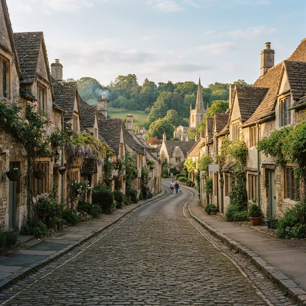
Unlike listing, which protects individual buildings, a conservation area protects the character of a whole place — street patterns, boundary walls, trees, green spaces, historic shopfronts and the relationship between buildings — covering everything from Georgian squares and Victorian terraces to historic industrial sites, model villages and 20th-century garden suburbs.
Why It Matters
Conservation area status changes what a homeowner, developer or investor can do to a property without needing full planning permission, and it is one of the most common designations picked up during a property purchase. It is checked by conveyancing solicitors as part of standard due diligence, by planning consultants assessing an alteration or extension, and by developers assessing whether an infill or redevelopment site is realistic.
Because conservation area status is often paired with an Article 4 Direction removing specific permitted development rights, the practical impact can be significantly greater than the conservation area designation alone suggests — a fact that is easy to miss without checking both layers together.
How to Interpret the Map
Shaded polygon
The designated conservation area boundary, as adopted by the local planning authority.
Boundary line
The precise edge of the designation — properties on the boundary line may be partly in and partly out.
No shading
Land outside every mapped conservation area — this does not mean the site is free of other heritage constraints, such as listed buildings nearby.
Conservation Areas Layer in the Maplify Map
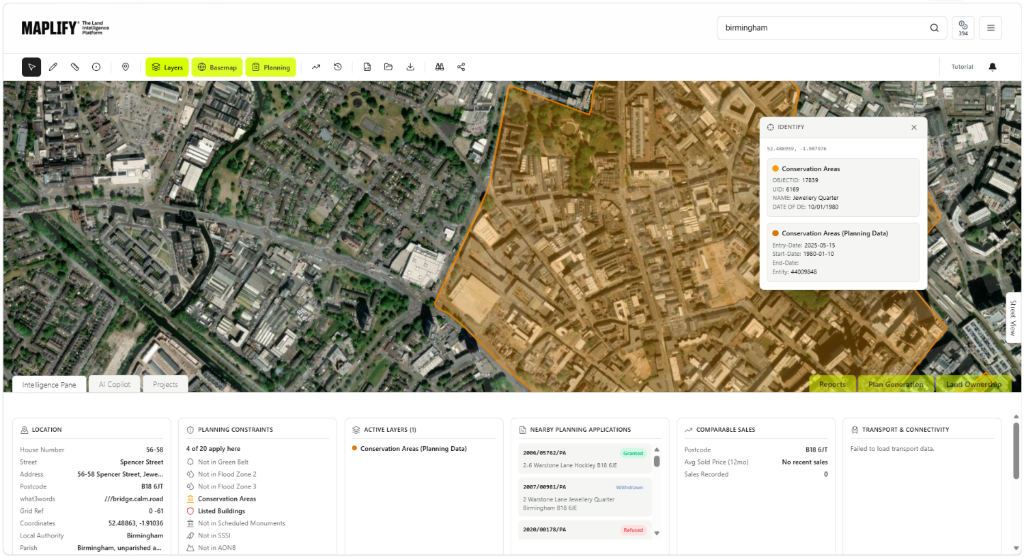
The Conservation Areas layer enabled on the Maplify map, showing the designated boundary alongside planning constraints, nearby applications and comparable sales data.
Planning and Development Implications
Conservation area status brings three main controls into play. First, conservation area consent is required to demolish any building within the area, including unlisted ones — unauthorised demolition is a criminal offence carrying an unlimited fine. Second, a Section 211 notice must be given to the local planning authority six weeks before works to most trees over a certain size, even without a Tree Preservation Order in place. Third, local planning authorities frequently apply Article 4 Directions within conservation areas, removing permitted development rights that would otherwise allow extensions, cladding, window replacement or roof alterations without an application.
None of these controls prevent development outright — they mean more works require a planning application and closer design scrutiny than they would outside the designation.
What to Do When a Site Is Affected
- 1Confirm the exact conservation area boundary and check for an accompanying Article 4 Direction with the local planning authority.
- 2Request the conservation area appraisal and management plan, which sets out what the authority considers to be the special character worth protecting.
- 3If demolition or significant alteration is planned, budget time for a conservation area consent application alongside standard planning permission.
- 4Check the Listed Buildings and Tree Preservation Orders layers for the same site, since these designations frequently overlap.
- 5Speak to a heritage or planning consultant before finalising design proposals for anything more than minor works.
This is general guidance, not professional or legal advice — confirm specifics with the relevant authority or a qualified professional.
Official Data Source
Data Freshness
Important Limitations
- Conservation area boundaries are for screening — confirm the exact boundary and any accompanying Article 4 Direction with the local planning authority.
- Conservation area appraisals and management plans vary by authority and may add further specific requirements not shown on the map.
- This map does not replace pre-application planning advice for demolition or significant alteration works.
- A very recently designated conservation area may not yet appear if the local authority has not published updated boundary data.
Common Use Cases
Property Developers
Assess whether an infill or redevelopment site carries added design and consent risk.
Planning Consultants
Advise on conservation area consent requirements and design approach for alterations.
Architects
Understand material and massing constraints early when designing extensions or new builds.
Surveyors
Factor conservation area status into condition and valuation reports.
Solicitors
Flag conservation area and Article 4 status during conveyancing due diligence.
Landowners
Understand what alterations remain permitted development before commissioning design work.
Related Layers
Conservation area checks are rarely run in isolation.
Frequently Asked Questions
How do I check if my property is in a conservation area?
Search the property on Maplify and enable the Conservation Areas layer. If the property falls within a shaded boundary, it is designated and enhanced planning controls apply.
Can I demolish a building in a conservation area?
Conservation area consent is required for demolition of any building in a conservation area, including unlisted ones. Unauthorised demolition is a criminal offence with an unlimited fine.
Do I need permission to work on trees in a conservation area?
Yes. A Section 211 notice must be given to the local planning authority six weeks before works to trees over a certain size, even without a Tree Preservation Order — the council can use that period to make a TPO.
Does a conservation area remove permitted development rights?
Not automatically, but many conservation areas have an accompanying Article 4 Direction that does remove specific permitted development rights, commonly for extensions, cladding and window replacement.
How does conservation area status affect a property purchase?
It is typically revealed in a CON29 Local Authority Search. It can mean reduced development potential and, in some cases, stricter mortgage lending or insurance criteria — factor this in before making an offer.
Do conservation areas cover whole streets or just special buildings?
Conservation areas protect the character of an area as a whole — street layout, boundary walls, trees, open spaces and building groupings — not just individually listed buildings within it.
Check Conservation Area Status on Maplify
Open the map, generate a site report or save your search to come back to it later.
Reviewed by the Maplify data & editorial team
Maplify displays official-source data for desktop screening and due diligence. We document where each dataset comes from, how it is processed, when it is checked and where its limitations matter.