

Source: Natural England
SAC, SPA & Ramsar Map UK
Search any UK location to check for internationally protected sites and understand the Habitats Regulations Assessment process that follows.
Updated: as Natural England amends boundaries · Last checked by Maplify: August 2026
What This Layer Shows
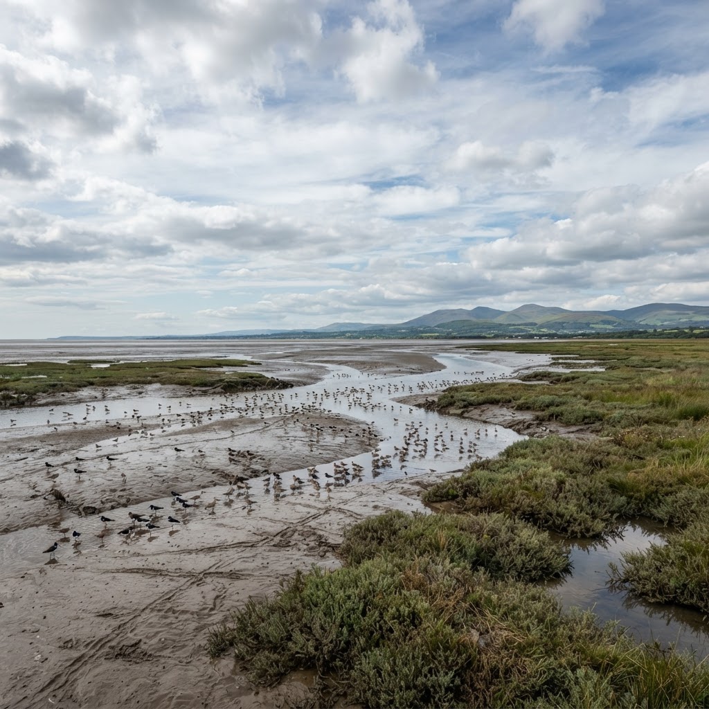
This layer maps three internationally significant nature designations: Special Areas of Conservation (SAC), which protect habitats and species under the Habitats Regulations; Special Protection Areas (SPA), which protect rare and migratory birds; and Ramsar sites, which protect internationally important wetlands. Together they form the UK's network of European and internationally protected sites, most of which also carry SSSI status.
Each site is defined by specific qualifying habitats or species — such as particular bird populations at an SPA, or a designated habitat type at an SAC — and it is these specific features, rather than the site generally, that any assessment must address.
Why It Matters
These designations carry the highest tier of ecological protection in UK and international law, and development affecting them — even from some distance — can trigger a Habitats Regulations Assessment (HRA), a legally required test that sits alongside and separately from standard planning assessment. Developers and ecologists check this layer at the earliest feasibility stage because an HRA can materially affect programme, cost and, in some cases, the fundamental viability of a scheme.
Critically, impacts are not limited to the site boundary: recreational pressure, nutrient run-off and water abstraction from developments some distance away can all trigger assessment, a "zone of influence" concept that is easy to overlook without checking this layer directly.
How to Interpret the Map
Special Area of Conservation (SAC)
Protects habitats and species under the Habitats Regulations.
Special Protection Area (SPA)
Protects rare and migratory bird populations.
Ramsar site
Protects internationally important wetlands.
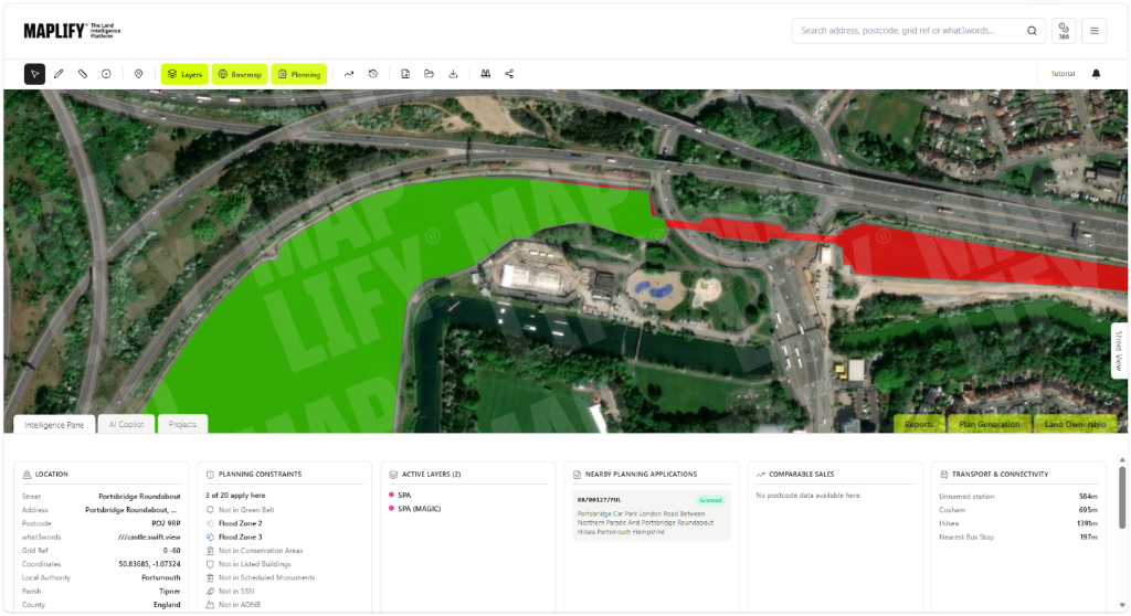
SAC / SPA Layer in the Maplify Map
Planning and Development Implications
Any plan or project that could have a significant effect on a European site, either alone or in combination with other plans or projects, requires a Habitats Regulations Assessment before consent can be granted. If the assessment cannot rule out an adverse effect on site integrity, consent can only proceed where there are no feasible alternatives, imperative reasons of overriding public interest exist, and compensatory measures are secured — a demanding test that few schemes meet.
Because the "zone of influence" for these sites can extend for kilometres — particularly for recreational disturbance to breeding or wintering birds — many housing schemes well outside the site boundary still require mitigation, such as financial contributions to alternative recreational greenspace or wardening schemes.
What to Do When a Site Is Affected
- 1Confirm the exact site boundary, qualifying features and zone of influence guidance with Natural England.
- 2Commission a Habitats Regulations Assessment screening exercise at the earliest feasibility stage.
- 3Check the SSSI layer for the same site, since most SAC/SPA/Ramsar sites are also notified as SSSIs.
- 4Budget for mitigation contributions if the site falls within a recognised zone of influence for recreational pressure.
- 5Engage Natural England pre-application where an adverse effect on site integrity cannot be ruled out.
This is general guidance, not professional or legal advice — confirm specifics with the relevant authority or a qualified professional.
Official Data Source
Data Freshness
Important Limitations
- Site boundaries shown on Maplify are for screening — confirm the exact boundary and qualifying features with Natural England.
- Zone of influence guidance varies by site and development type and is not fully captured by the boundary alone.
- This map does not replace a Habitats Regulations Assessment screening exercise.
- A very recent boundary or guidance amendment may not yet appear if source data has not been updated.
Common Use Cases
Property Developers
Screen sites for zone of influence risk before committing to acquisition.
Environmental Consultants
Scope Habitats Regulations Assessments and mitigation strategies.
Planning Consultants
Advise on the legal test and likely mitigation contribution requirements.
Architects
Design layouts that reduce recreational pressure on nearby protected sites.
Surveyors
Factor HRA risk into valuation and feasibility reports.
Landowners
Understand designation status before commissioning land management works.
Related Layers
SAC, SPA and Ramsar checks are commonly run alongside these related layers.
Related Guides
Frequently Asked Questions
How do I check if a site is affected by SAC, SPA or Ramsar designation?
Search the site on Maplify and enable the SAC, SPA and Ramsar layers. Impacts are not limited to sites within the boundary — check the "zone of influence" guidance for developments some distance away too.
What is a Habitats Regulations Assessment?
A legally mandated test assessing whether a plan or project could adversely affect the integrity of a protected European site (SAC, SPA or Ramsar), applied in addition to — and separately from — normal planning assessment.
Can development still proceed if an HRA is required?
Yes, but only if the assessment concludes no adverse effect on site integrity, alone or in combination with other plans or projects, or if strict derogation tests (imperative reasons of overriding public interest, no alternatives, compensatory measures) are met.
Why can a development miles away still need an HRA?
Recreational pressure, nutrient run-off, water abstraction and air quality changes can affect a protected site's integrity from a considerable distance — this is known as the site's "zone of influence" and is assessed regardless of direct boundary overlap.
Do SAC, SPA and Ramsar sites overlap with SSSI?
Very commonly. Most sites are also notified as SSSIs, so checking both layers together gives the fullest picture of the ecological protection that applies.
What is the difference between SAC, SPA and Ramsar?
SAC protects habitats and species under the Habitats Regulations, SPA protects rare and migratory birds, and Ramsar protects internationally important wetlands — together they form the UK's network of internationally significant nature sites.
Check SAC, SPA & Ramsar Status on Maplify
Open the map, generate a site report or save your search to come back to it later.
References and Methodology
Reviewed by the Maplify data & editorial team
Maplify displays official-source data for desktop screening and due diligence. We document where each dataset comes from, how it is processed, when it is checked and where its limitations matter.