
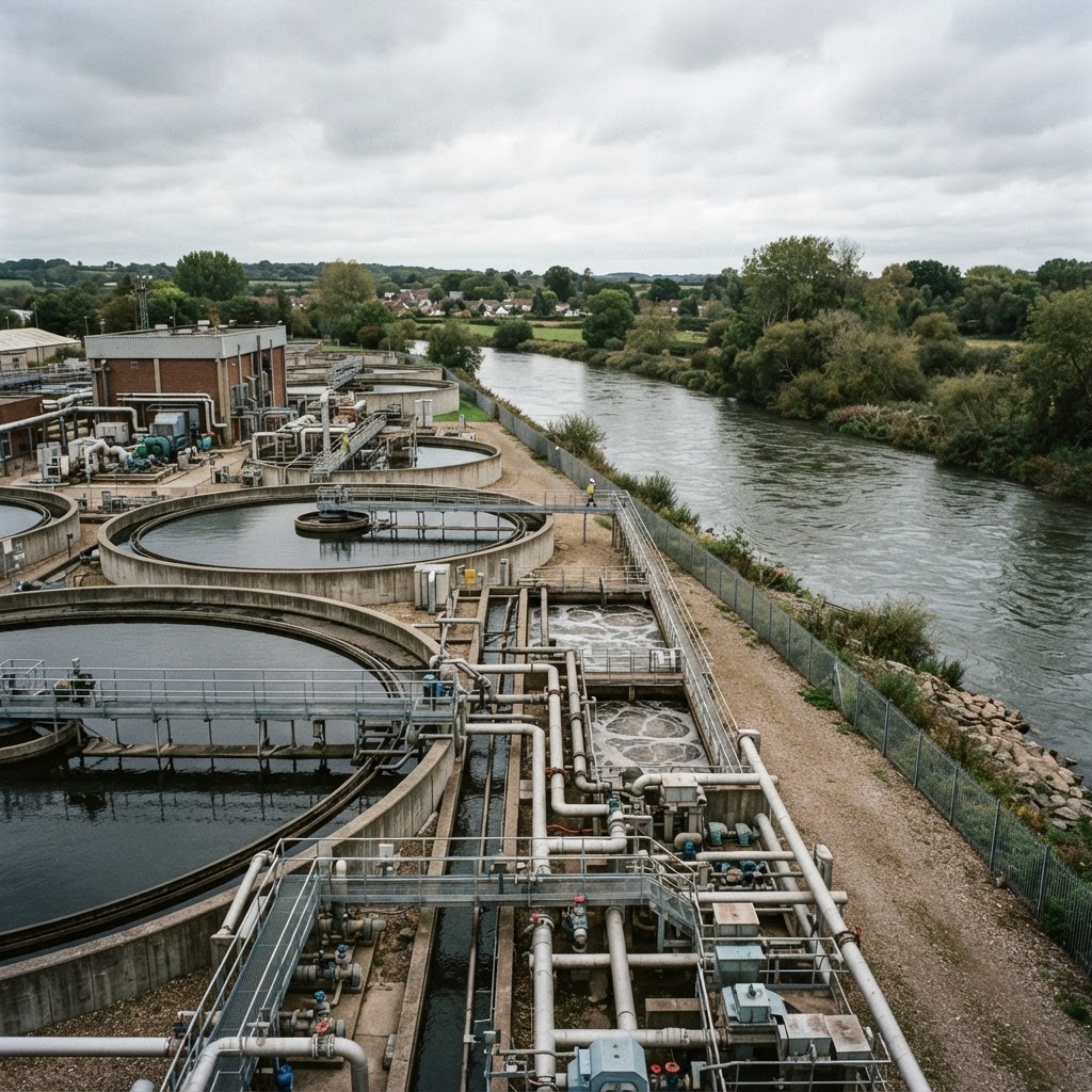
Source: Environment Agency & Water Companies
Water Industry & Utilities Map UK
Search any UK location to check water company assets, treatment works, storm overflows and water quality monitoring before you buy, plan or develop.
What This Layer Shows
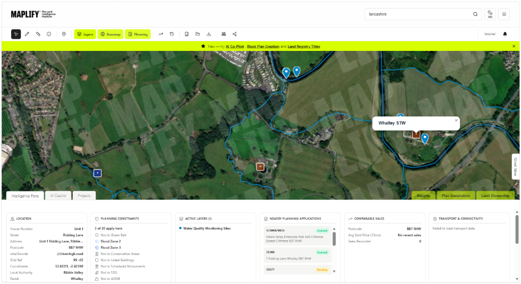
This layer maps water industry infrastructure across England: water and sewerage company operational boundaries, sewage and wastewater treatment works, drinking water treatment works, storm overflows (CSOs), water abstraction licences, discharge consents, pumping stations, reservoirs, and the water distribution and sewerage network. It also includes Environment Agency water quality monitoring sites and Water Framework Directive classified water bodies.
Together these layers give a picture of the water and wastewater infrastructure serving an area, which is relevant both to environmental screening and to practical questions about servicing a new development.
Why It Matters
Water and sewerage capacity is a practical constraint for almost every development, and nearby treatment works, pumping stations or storm overflows can carry odour, noise or environmental implications that planning officers and environmental health teams take seriously. Developers and environmental consultants check this layer early to flag any nearby infrastructure that could affect amenity or require a formal capacity assessment from the water company.
Storm overflow activity has also become a high-profile environmental issue, with frequency and location of discharges increasingly scrutinised by regulators, campaigners and local communities — proximity to a frequently discharging CSO can be a material consideration for riverside or coastal sites.
How to Interpret the Map
Water Company Areas
Operational boundaries of the water and sewerage company serving an area.
Treatment Works
Sewage, wastewater and drinking water treatment plant locations.
Storm Overflows (CSO)
Combined Sewer Overflow locations, often shown with monitoring data.
Water Quality Monitoring Sites
Environment Agency sampling locations for river and coastal water quality.
Water Industry & Utilities Layer in the Maplify Map
Planning and Development Implications
Proposals near a sewage treatment works or storm overflow may need an odour or amenity assessment, and environmental health input is commonly sought for residential schemes in close proximity. Confirming that adequate water and sewerage capacity exists — or can be provided — is also standard due diligence before a planning application is submitted, and the local water company should be consulted formally rather than relying on mapped infrastructure alone.
Sites near frequently discharging storm overflows or classified water bodies may also attract closer scrutiny under water quality and environmental protection policy, particularly for schemes affecting drainage or requiring new outfalls.
What to Do Next
- 1Identify the water and sewerage company serving the site and confirm formal connection and capacity requirements.
- 2Check for nearby treatment works or storm overflows that could raise odour or amenity considerations.
- 3Review Water Framework Directive water body status if the site is near a river, lake or coastal water body.
- 4Commission an odour or environmental assessment where a residential scheme sits close to treatment infrastructure.
- 5Check the Flood Risk and Rivers, Lakes & Water layers for the same site for the fuller water picture.
This is general guidance, not professional or legal advice — confirm specifics with the relevant authority or a qualified professional.
Official Data Source
Data Freshness
Important Limitations
- Infrastructure layers are for screening — confirm formal capacity and connection requirements with the relevant water company.
- Storm overflow monitoring data availability and frequency reporting can vary by site and operator.
- This map does not replace a site-specific drainage strategy or odour assessment for a planning application.
- A very recent change to network infrastructure may not yet appear if source data has not been updated.
Common Use Cases
Property Developers
Screen sites for water and sewerage capacity and nearby infrastructure constraints.
Environmental Consultants
Scope odour, drainage and water quality assessments.
Planning Consultants
Advise on likely conditions relating to servicing and environmental protection.
Surveyors
Factor nearby infrastructure into valuation and feasibility reports.
Landowners
Understand servicing constraints before commissioning design work.
Related Layers
Water industry checks are commonly run alongside these related layers.
Frequently Asked Questions
What water industry assets does this layer show?
Water and sewerage company operational boundaries, sewage and wastewater treatment works, drinking water treatment works, storm overflows (CSOs), water quality monitoring sites, pumping stations, reservoirs and the water distribution and sewerage network.
Why do developers check water industry infrastructure?
Nearby treatment works, pumping stations and storm overflows can carry odour, noise or capacity implications for new development, and connecting to water and sewerage networks is a standard condition of most schemes.
What is a storm overflow (CSO)?
A Combined Sewer Overflow releases untreated sewage mixed with rainwater into a watercourse during heavy rain to prevent sewer flooding — their frequency and location are increasingly scrutinised for environmental and amenity reasons.
Does this layer show whether a site can connect to mains sewerage?
It shows the general network and treatment infrastructure in the area, but a formal capacity and connection assessment must be obtained from the relevant water company before relying on connection being straightforward.
How often is water industry data updated?
Data is sourced from the Environment Agency and water company published datasets and is checked periodically as new extracts are published.
Does proximity to a sewage works affect planning permission?
It can. Odour and amenity impacts from nearby treatment works are a material consideration, and environmental health input is often sought for residential proposals near this infrastructure.
References and Methodology
Reviewed by the Maplify data & editorial team
Maplify displays official-source data for desktop screening and due diligence. We document where each dataset comes from, how it is processed, when it is checked and where its limitations matter.