
Planning constraints map
Understand the designations and restrictions that may shape a development proposal, then explore each relevant layer in detail.
Search any site and see planning, flood, ownership and environmental constraints on one interactive map — 265+ official UK data layers in an instant.
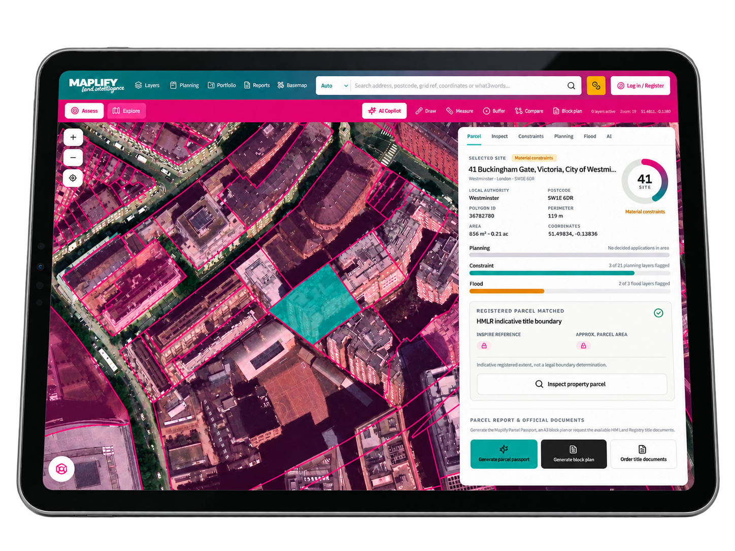
Enter a postcode, address, place, grid reference or Land Registry title number to jump straight to that location on the Maplify map and switch on the data layers you need.
Maplify is a screening and due-diligence tool. Verify critical planning, legal and environmental matters with the relevant authority or qualified professional.
Start with the topic that matters to your property or project. Each area links directly to a dedicated map, tool or detailed guide.
Understand the designations and restrictions that may shape a development proposal, then explore each relevant layer in detail.
Investigate river, sea and surface-water flood risk early in the site selection process. A map is a starting point, not a substitute for a site-specific flood risk assessment.
Locate registered title information and explore mapped property boundaries. Treat general map outlines as indicative, and verify legal boundaries against title documents.
Explore planning permission requirements, nearby applications and planning history before deciding on a proposal or instructing a consultant.
Review the natural and historic environment around a site, including protected habitats, protected trees, designated buildings and potential land contamination.
Build an evidence-led initial site assessment by reviewing planning policy, physical risk, access, infrastructure and ownership information in context.
Maplify's free community initiative
Our free Community Flood Mapping Project helps flood action groups combine Environment Agency flood layers with local knowledge about drainage issues, historical flooding, refuge points and potential dry routes. Build and share a map that your community can understand.
View-only project links can be shared freely. Editing a group map is restricted to authorised group members. For emergency decisions, follow official flood warnings.
New to site appraisal, or need to double-check a particular constraint? These step-by-step resources explain where to look, what the mapped evidence means and when to seek further advice.
Read the site constraints guide →Dive into a wealth of tools, free maps and reports to help you understand any UK site, from planning constraints to flood risk.

Check Green Belt status on a free interactive map.

Enter a postcode to see flood zones and surface water risk.

Find title boundaries and ownership information.

A PDF report for any UK site in minutes.

Use our free planning permission checker.

Professional flood risk assessment for your site.
Whether you are buying a plot, preparing a planning application or screening a development opportunity, the first question is often the same: what could affect this site? Maplify helps you explore location-based land information on an interactive map and move from a broad site search to more focused checks.
Review planning designations, investigate environmental risks, explore ownership and boundaries, and find the reports and guidance relevant to your next decision. Different datasets cover different geographies and dates, so always check the original source and obtain professional advice where appropriate.
A useful planning constraints check is more than a single coloured overlay. Take a repeatable approach, and separate preliminary screening from formal due diligence.
Search an address, postcode or location in the interactive map. Establish the site boundary and surrounding context before drawing conclusions.
Open the interactive map →Switch on planning, flood, heritage, ecology and infrastructure layers to identify issues worth investigating further.
Explore map data layers →Check the applicable local planning authority, original datasets, dates and any supporting documents. Map overlays can be incomplete or change over time.
Find a planning authority →Use a checklist or a report to organise initial findings, record outstanding questions and brief the right professional advisers.
Browse site reports →Important: Mapping and screening tools do not determine whether planning permission will be granted, confirm exact legal title boundaries, or replace official property searches and professional surveys.
Screen potential acquisition sites and understand planning or environmental red flags before committing resources.
Explore solutions →Put policy, designations and site constraints into a clear geographical context for initial appraisal.
Explore solutions →Explore the surrounding built environment and understand site constraints during feasibility and early design.
Explore solutions →Find useful context for client enquiries while retaining formal searches and title checks.
Explore solutions →Yes. The Maplify Community Flood Mapping Project brings together published Environment Agency flood layers and local knowledge such as drainage issues, historical flood points and possible dry routes. Authorised group editors use an assigned code, and residents can open view-only project links for free. Community information does not replace official flood warnings.
Land intelligence is the combination of planning, ownership, environmental, infrastructure and market data that lets property professionals understand the true potential and risk of a site before committing time or money. Maplify brings all of this together in one Land Intelligence Platform.
Use Maplify's site discovery tools to search any UK location and instantly see ownership, planning designations, flood risk and infrastructure constraints, helping you shortlist genuine development opportunities faster.
Search a postcode, address or grid reference on the Maplify planning constraints map to see Green Belt, conservation areas, listed buildings, Article 4 directions and local planning designations for any site.
Maplify overlays planning history, ownership, environmental risk and market data on one map so you can assess a site's development potential in minutes rather than days of manual due diligence.
Maplify includes Land Registry boundaries and ownership, planning applications and designations, flood risk, heritage and ecology constraints, ground and geology risk, utilities and infrastructure, and market comparables — sourced from public authorities and other data publishers, with coverage varying by layer.
Maplify is used by property developers, housebuilders, planning consultants, architects, surveyors, land promoters, utilities providers, renewables developers, local authorities and investors across the UK.
Yes. Maplify is built specifically for developers and housebuilders to reduce site risk, find better opportunities and accelerate due diligence with live planning and environmental intelligence.
Yes. Maplify lets you generate professional site feasibility and block plan reports directly from the map, ready to share with clients or colleagues.
Yes. Maplify integrates HM Land Registry title and ownership data, including company ownership records, alongside every other layer on the platform.
Yes. You can search any UK postcode, address, OS grid reference or Land Registry title number to instantly locate a site on the map.
Maplify offers a free tier to get started, with paid plans for teams needing higher usage limits, report exports and additional data layers. See our Pricing page for full details.
No. Maplify is a screening and due-diligence tool that surfaces official data quickly, but it does not replace professional legal, planning or surveying advice. Always verify critical matters with a qualified professional or the relevant local planning authority.
Maplify brings together published data from HM Land Registry, the Environment Agency, Natural England, Historic England, local authorities and other sources. Publication and refresh dates vary by layer: verify significant findings against the source record.
Yes. Maplify is fully responsive and works on desktop, tablet and mobile, so you can check planning constraints and site intelligence on a site visit as well as at your desk.
Need further help? Browse the help centre and FAQs, learn about our methodology, or compare available plans.