
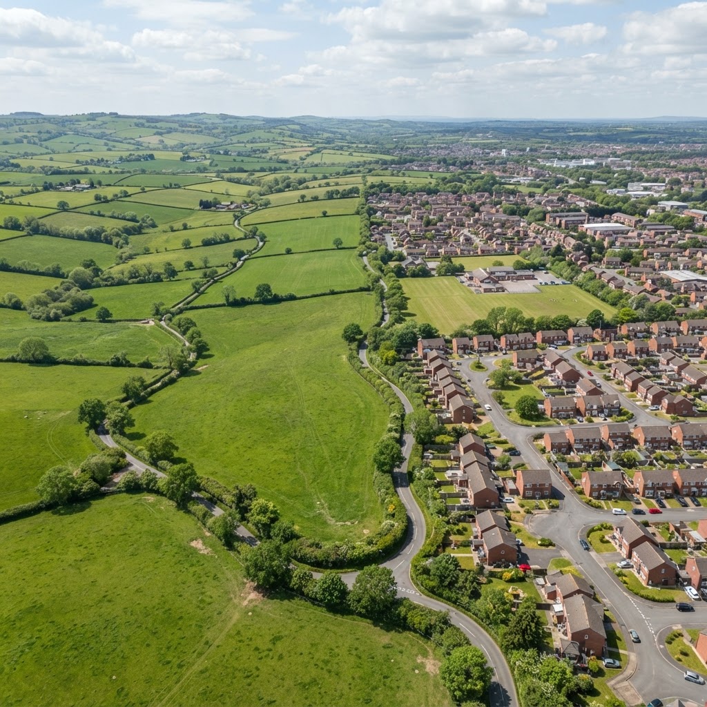
Is My Land In The Green Belt? How To Find Out
Green Belt land in England has some of the strongest planning protection in the entire system. If you're buying land, appraising development opportunities, or simply want to know whether your property is affected, checking Green Belt status is one of the first steps in any property due diligence exercise.
This guide explains exactly how to check if land is Green Belt, what it means in practice, and whether there's any realistic prospect of development.
How To Check If Land Is In The Green Belt
Method 1 — Use the Maplify Green Belt Map Checker
The simplest approach: use our free Green Belt map checker. Enter any UK postcode or click anywhere on the interactive map to see whether the land falls within a Green Belt designation. The map uses the latest Local Authority data across all 14 English Green Belts.
Method 2 — Check Your Local Planning Authority Policies Map
Each Local Planning Authority publishes an Interactive Policies Map (sometimes called a Proposals Map) as part of their Local Plan. Green Belt boundaries are shown clearly on these maps. Search for "[your council name] interactive policies map" or "[council name] local plan map" to find it.
Method 3 — Submit a Planning Enquiry
For certainty, submit a pre-application enquiry to your Local Planning Authority asking them to confirm the Green Belt status of a specific parcel. Most councils respond within 10–20 working days. This provides a written confirmation you can rely on in due diligence.
The 14 Green Belts in England
England has 14 separate Green Belt areas, covering approximately 12.4% of the country's land area. The largest are:
- Metropolitan Green Belt — surrounding Greater London, the largest in England
- West Midlands Green Belt — around Birmingham, Coventry, and the Black Country
- Greater Manchester Green Belt
- Merseyside and Greater Manchester Green Belt
- South and West Yorkshire Green Belt
- North East Green Belt (Tyne and Wear)
- Nottingham and Derby Green Belt
- Bristol and Bath Green Belt
Green Belt Planning Restrictions — What Is Actually Permitted?
The NPPF defines what constitutes "appropriate development" within the Green Belt. Inappropriate development is by definition harmful and should not be approved except in very special circumstances. Appropriate development includes:
- Mineral extraction
- Agricultural and forestry buildings
- Extensions to existing buildings (subject to limits)
- Replacement dwellings (not exceeding the footprint of the original)
- Re-use of existing buildings (provided they don't change the openness of the Green Belt)
- Limited infill within existing settlements within the Green Belt
- Limited affordable housing for local community needs
Can You Build On Green Belt Land?
In general terms, no — not unless you can demonstrate "very special circumstances" that clearly outweigh the harm to the Green Belt. In practice, this is an extremely high bar. Common attempts that fail include general housing need, economic development without special justification, and speculative commercial development.
However, there are exceptions that can succeed with the right planning consultant and evidence:
- Previously developed (brownfield) land within the Green Belt
- Exception sites for affordable/social housing meeting an identified local need
- Enabling development (heritage at risk)
- Community facilities with strong local support
Green Belt vs Grey Belt — What's the Difference?
The Labour Government introduced the concept of "Grey Belt" in 2024 as part of planning reforms. Grey Belt refers to previously developed land and other land within the Green Belt that makes limited contribution to Green Belt purposes. Under the reformed NPPF (December 2024), Grey Belt land may be released for development subject to "golden rules" including affordable housing requirements. This is a significant policy change that may increase development opportunities on lower-quality Green Belt land.
Green Belt Map By Postcode
To check Green Belt status by postcode, use our interactive Green Belt map. The tool geocodes your postcode and displays Green Belt boundaries at a detailed scale, alongside other constraint layers such as flood risk and conservation areas.
Does Green Belt Designation Affect Land Value?
Enormously. Green Belt land typically has an agricultural value of £8,000–£20,000 per hectare. The same land with planning permission for housing could be worth £1–5 million per hectare or more. This "hope value" means Green Belt land adjacent to settlement boundaries often trades at premiums above pure agricultural value, but buyers should be extremely cautious — the probability of achieving planning in most Green Belt locations remains very low.
How To Remove Land From the Green Belt
Green Belt boundaries can only be changed through the Local Plan review process, which typically takes 5–10 years. To promote land for Green Belt release you need to:
- Identify when the Local Planning Authority is reviewing their Local Plan
- Submit a "Call for Sites" representation promoting your land
- Commission technical studies (transport, ecology, flood risk) to demonstrate suitability
- Engage a planning consultant to represent you through the Examination in Public
- Obtain an Inspector's finding that the site is suitable, available, and achievable
This process is long, uncertain, and expensive. Success depends heavily on the specific Local Plan context and competing sites.
Buying Green Belt Land — Key Considerations
- Confirm Green Belt status using our map tool before negotiating
- Check whether any "grey belt" criteria apply under the reformed NPPF
- Investigate Local Plan timetable — are boundaries being reviewed?
- Check proximity to settlement edges — land close to boundaries may have better prospects
- Consider all other constraints (flood risk, ecology, heritage) using our site identification tool
- Take specialist planning advice before paying any premium above agricultural value
Frequently Asked Questions
How do I check Green Belt status for free?
Use Maplify's free Green Belt map or check your Local Planning Authority's interactive policies map.
Can I extend my house in the Green Belt?
Yes, within limits. The original dwelling can typically be extended under permitted development up to 50% of the original floor area (subject to local restrictions including Article 4 Directions). Check our Article 4 map to see if your area has additional restrictions.
Is Green Belt the same as greenfieldland?
No. Green Belt is a specific planning designation. Greenfield simply means land that hasn't been previously developed (as opposed to brownfield). Green Belt land can contain brownfield sites, and most greenfield land is not in the Green Belt.