
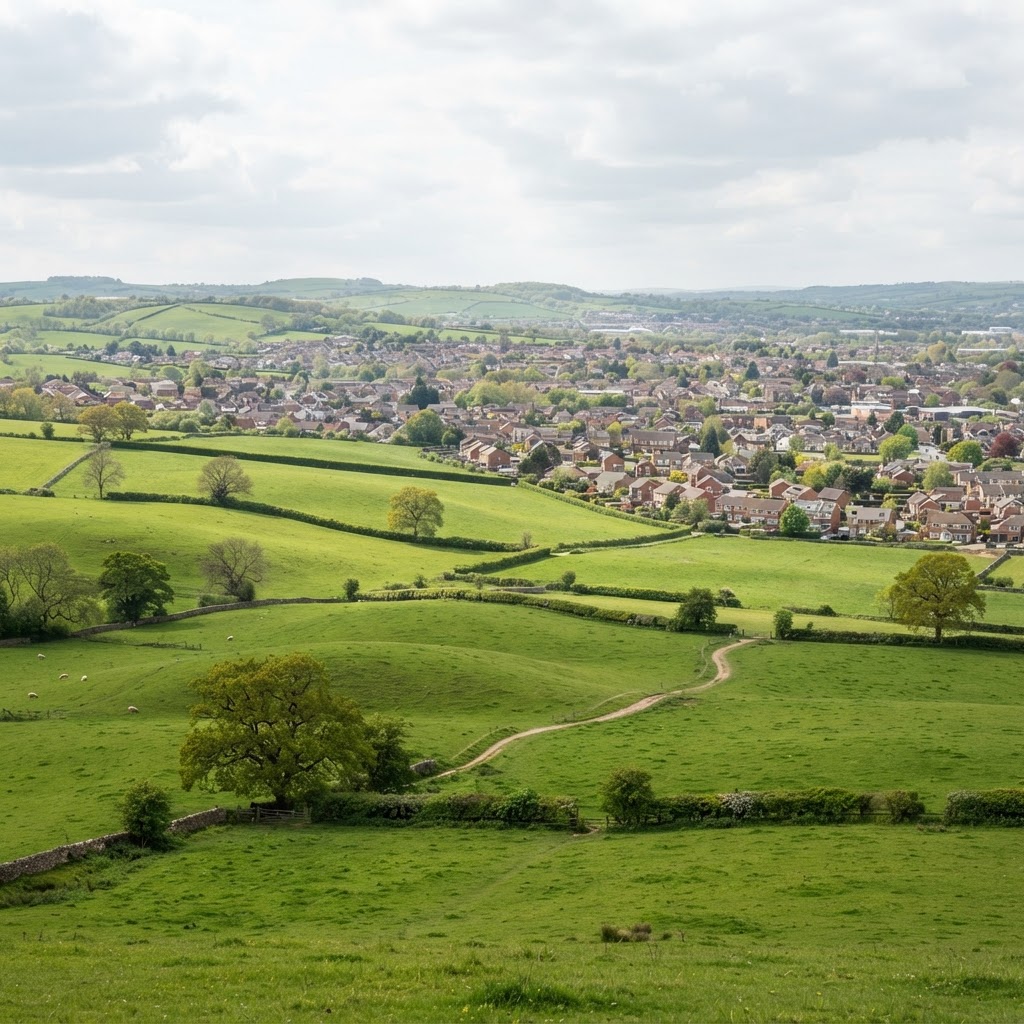
What is Green Belt Land?
Green Belt is a planning designation covering approximately 13% of England (around 1.6 million hectares). Introduced in the 1950s, Green Belt land serves five essential purposes defined in the National Planning Policy Framework (NPPF):
- Check unrestricted sprawl of large built-up areas
- Prevent neighbouring towns merging into one another
- Assist in safeguarding countryside from encroachment
- Preserve the setting and special character of historic towns
- Assist in urban regeneration by encouraging recycling of brownfield land
Green Belt is not a landscape designation like Areas of Outstanding Natural Beauty (AONB) or National Parks. Land quality is irrelevant - Green Belt includes farmland, woodland, golf courses, and even derelict brownfield sites. The purpose is controlling urban expansion, not protecting beautiful countryside.
Green Belt Coverage Across England
Green Belt surrounds major cities including London, Birmingham, Manchester, Liverpool, Sheffield, Newcastle, and Nottingham. The largest Green Belt is the Metropolitan Green Belt around London (514,000 hectares), followed by the North West Green Belt (255,000 hectares).
Check if land is in Green Belt using our free Green Belt map viewer. Simply enter a postcode to see Green Belt boundaries overlaid on an interactive map.
What Development is Allowed in Green Belt?
Development in Green Belt is strictly controlled by national planning policy. The current NPPF specifies forms of development that are "not inappropriate" in Green Belt:
Appropriate Development in Green Belt
Agriculture and forestry buildings - Agricultural buildings, farm shops, and forestry structures are appropriate. However, the buildings must be genuinely required for agricultural or forestry operations, not residential conversions disguised as barns.
Outdoor sport and recreation - Sports facilities, golf courses, horse riding schools, and outdoor recreation uses that preserve openness are appropriate. This excludes substantial built facilities like clubhouses or grandstands.
Cemeteries and burial grounds - Essential infrastructure that preserves Green Belt openness. Crematoria buildings may face closer scrutiny depending on size and design.
Limited infilling in villages - Small-scale residential development filling gaps between existing buildings within identified village boundaries. "Infilling" means filling a small gap, not expanding settlement limits.
Limited affordable housing for local needs - Exception sites for affordable housing where it meets identified local need, with restrictions on occupancy and resale.
Extensions or alterations to existing buildings - Provided they are not disproportionate to the original building. "Disproportionate" typically means extensions over 30-50% of original volume, though this varies by Local Planning Authority.
Replacement buildings - Replacing existing buildings on a one-for-one basis, provided the replacement is not materially larger than the building it replaces. Some authorities allow modest increases (e.g., 10% volume increase).
Limited infilling or redevelopment of previously developed land - Development on brownfield sites in Green Belt is allowed where it does not harm openness and preserves Green Belt purposes.
Very Special Circumstances Test
If proposed development is "inappropriate" in Green Belt (doesn't fall within the exceptions above), it can only be permitted if applicants demonstrate very special circumstances.
NPPF states that inappropriate development is, by definition, harmful to Green Belt and should not be approved except in very special circumstances. This is a high bar to overcome.
What Constitutes Very Special Circumstances?
Very special circumstances must clearly outweigh the harm by reason of inappropriateness plus any other identified harm. Factors that may contribute to very special circumstances include:
- Significant economic benefits - Major job creation, inward investment, or regeneration benefits that cannot be delivered elsewhere
- Essential infrastructure - Schools, hospitals, utilities that must serve a specific location and no suitable alternative sites exist
- Personal circumstances - Exceptional family circumstances, though rarely sufficient alone. Agricultural workers' dwellings may qualify if functionally essential to farm operations
- Lack of 5-year housing land supply - Where the Local Planning Authority cannot demonstrate 5-year housing supply, this may contribute but rarely outweighs Green Belt harm alone
- Removal of existing greater harm - Development that removes existing eyesores, restores derelict sites, or significantly enhances openness may demonstrate special circumstances
Very special circumstances arguments must be site-specific and substantiated with evidence. Generic claims about housing need or economic benefits without demonstrating why this specific Green Belt site is necessary will fail.
Green Belt and Permitted Development Rights
Permitted development rights allow certain building works without planning permission. However, permitted development rights are significantly restricted in Green Belt:
Residential Permitted Development in Green Belt
House extensions - Rear extensions are limited to 3 metres (semi-detached/terraced) or 4 metres (detached). Side extensions require planning permission. Extensions must not increase original volume by more than 10% (terraced) or 15% (other houses), up to maximum 115 cubic metres.
Roof extensions and dormers - Not permitted development in Green Belt. Planning permission required.
Outbuildings - Garden buildings, garages, sheds are permitted if no more than 10 metres from the house and within volume allowances. Height limits apply (4 metres maximum, 2.5 metres if within 2 metres of boundary).
Agricultural buildings - Agricultural permitted development (Part 6) allows farm buildings up to 465 square metres subject to notification to the Local Planning Authority. However, notification is required in Green Belt.
Conversion of Buildings in Green Belt
Converting existing buildings to residential use requires planning permission in Green Belt. Class Q permitted development (agricultural buildings to dwellings) requires prior approval and strict tests apply.
The building must be:
- Structurally sound and capable of conversion without rebuilding
- In agricultural use on 20 March 2013 or a date specified in local policy
- Not result in harmful impact on Green Belt openness
Many barn conversion proposals fail because the building is derelict, rebuilt walls would be required, or the site requires extensive residential curtilage which harms openness. Check planning designations including Green Belt before purchasing barns for conversion.
Green Belt and Housing Development
Housing development in Green Belt faces the toughest restrictions. With acute housing shortages across England, pressure exists to release Green Belt for housing, but Government policy maintains strong protection.
Green Belt Release Through Local Plans
Local Planning Authorities can only release Green Belt through the Local Plan process, not individual planning applications. This requires:
- Exceptional circumstances - LPA must demonstrate exceptional circumstances justify altering Green Belt boundaries
- Full review - Complete Green Belt review considering all five purposes
- Sustainable patterns of development - Released sites must promote sustainable development patterns
- Compensatory improvements - Providing environmental improvements to remaining Green Belt
Exceptional circumstances typically arise from:
- Unmet housing need that cannot be met on non-Green Belt land
- Lack of alternative brownfield sites
- Urban regeneration efforts exhausted
- Strategic infrastructure requirements
Once Green Belt is released in a Local Plan and sites allocated for development, normal planning policies apply. However, the Local Plan process takes years and faces substantial public opposition.
Green Belt Review and Reform
Green Belt policy remains controversial. Supporters argue it prevents urban sprawl and protects countryside. Critics claim it constrains housing supply, increases prices, and forces longer commutes.
Is Green Belt Under Threat?
Despite pressure, Government maintains commitment to Green Belt protection. The NPPF was revised in 2026 and its current Green Belt provisions must be read in full, requiring higher standards for release and compensatory improvements.
However, some councils face difficult choices. Where housing need vastly exceeds non-Green Belt land supply, exceptional circumstances arguments strengthen. London boroughs and Home Counties authorities particularly struggle with this tension.
If you own land adjacent to development boundaries in Green Belt, monitor your Local Authority's Local Plan review. Sites on the edge of settlements performing weakly against Green Belt purposes may be considered for release.
Buying Property in Green Belt
Properties in Green Belt offer countryside living with protection from nearby development. However, buyers should understand the restrictions:
- Limited extension rights - Volume limits restrict how much you can extend. Check the property's planning history to see what volume has already been used
- Restricted permitted development - Many common home improvements require planning permission
- Change of use restrictions - Converting outbuildings to habitable accommodation requires permission and faces scrutiny
- Subdivision limitations - Splitting plots or building additional dwellings is generally inappropriate development
Always check what previous owners have built. Extensions and outbuildings count towards volume limits, even if built 30 years ago. Obtain planning history from the Local Planning Authority before purchase.
Business Development in Green Belt
Employment uses in Green Belt face similar restrictions to housing. However, some business uses may be appropriate:
Farm diversification - Agricultural businesses can diversify into tourism (camping, holiday lets), farm shops, or small-scale processing. These uses must be genuinely linked to farming operations and not harm openness.
Equestrian uses - Horse riding schools, livery yards, and equestrian facilities are common in Green Belt. Stables, arenas, and small ancillary buildings may be appropriate. Large commercial facilities face closer scrutiny.
Golf courses - Golf courses are appropriate recreation uses. Modest clubhouses and pro shops may be permitted if essential to operations.
For commercial development, consider checking planning constraints on previously developed sites outside the Green Belt, which are generally better suited to redevelopment.